From Forests to Fields

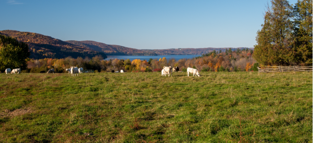
Photo Credit: Éric van Bochove
Background
One of the FMF’s mission is to preserve the Massawippi valley’s unique ecosystem.
What is the Massawippi Valley?
This area represents a regional identity and a specific community whom the Foundation wishes to serve. It comprises 5 municipalities: North Hatley, Hatley, Hatley Township, Sainte-Catherine-de-Hatley and Ayer’s Cliff.
What is the Massawippi watershed?
This area represents the ecological boundaries of the FMF’s activities, and extends beyond the aforementioned municipalities into the United States. It can be subdivided into 5 territory types: agricultural areas, anthropogenic areas (buildings, roads, other infrastructure), aquatic areas (lakes and rivers), forests and wetlands. When working within this territory, it is important to consider the varying character of land, the activities that occur on it and the ecological repercussions of those activities. As a result, some areas are more critical or sensitive than others.
Agriculture
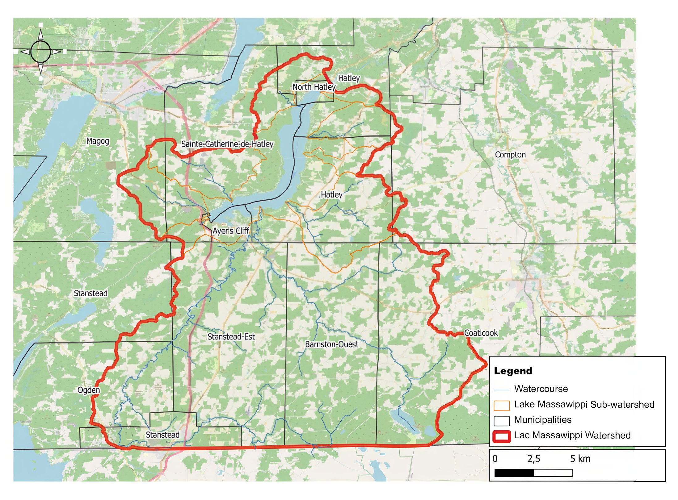
Massawippi Foundation’s priority is to preserve the natural ecosystems of the Lake Massawippi watershed [Figure 1]. Among its concerns is the interaction between the management of the various ecosystems and the development of the local economy, especially as ecological and aesthetic changes around the lake can have a considerable effect on the well-being of the communities in the Lake Massawippi watershed. It is with this in mind that Massawippi Foundation wishes to help farmers improve their land management in order to preserve natural resources and reduce the impact of agriculture on Lake Massawippi.
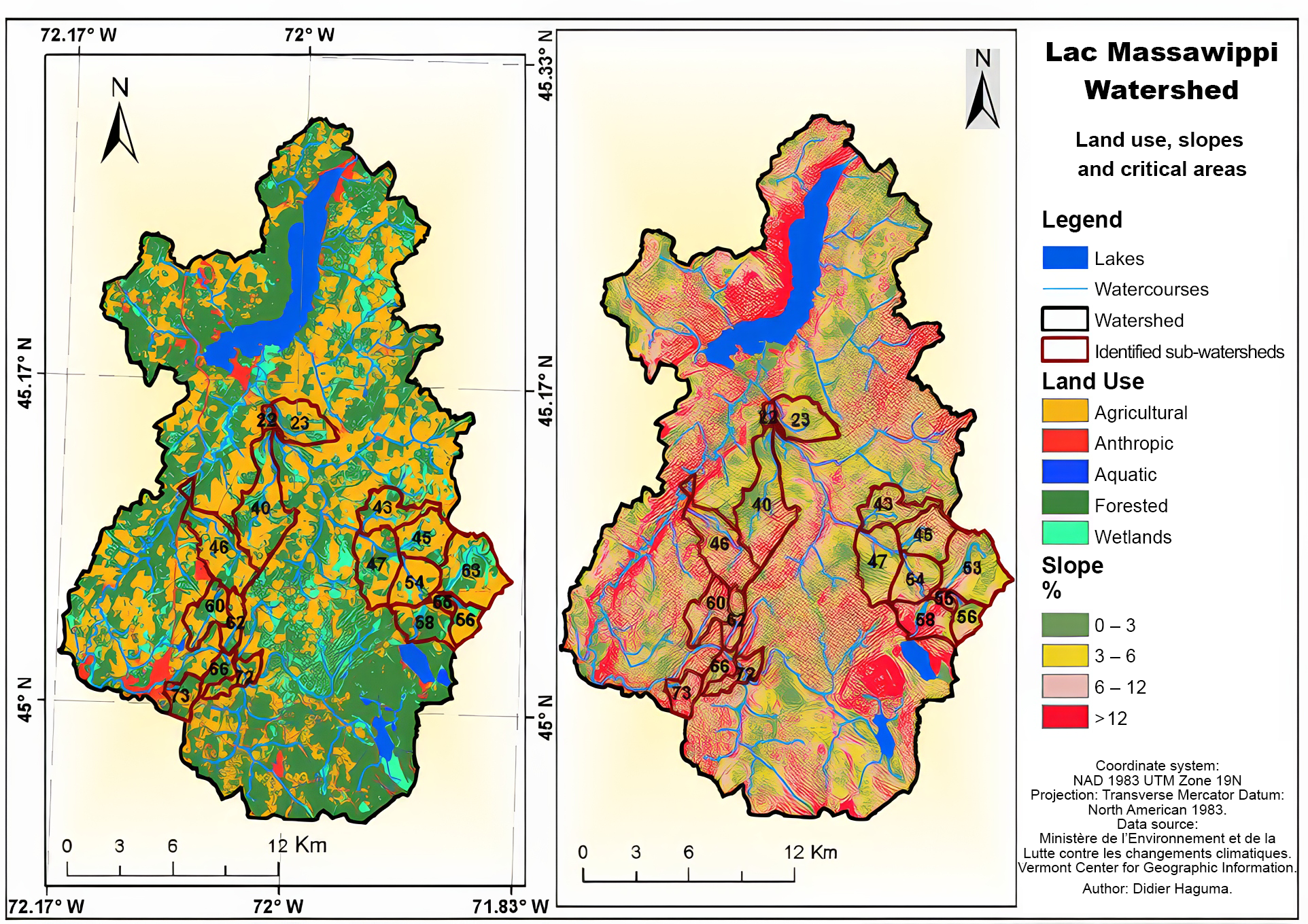
To strategically plan its interventions, Massawippi Foundation funded an initial research project in 2022-2023, carried out by the Université de Sherbrooke, to identify the most hydrologically active sites on agricultural land, at the source of diffuse pollution, on the scale of Lake Massawippi’s sub-watersheds, using an integrated modelling approach. The modelling results enabled us to identify the sub-watersheds with the highest risk of sediment, nitrogen and phosphorus losses from agricultural land [Figure 2]. The various simulations of non-point-source pollution mitigation scenarios indicated that restoring or expanding wetlands first and forested areas to a lesser extent would greatly reduce the impact of agricultural practices on the water quality of Lake Massawippi.
Project objectives
The next step will be to document and map on a detailed landscape scale the various physical factors (crops, soil management, soil type, slopes, water bodies, wetlands, forest, etc.) contributing to diffuse pollution by soil erosion and nutrient leaching (Nitrogen, Phosphorus) into ditches and small tributaries, using a Geographic Information System (GIS).
The objective of the research project is to develop a new GIS that will include the multi-dimensional data needed to analyze complex situations and make decisions for intervention by the Massawippi Foundation in the most at-risk landscape situations. The GIS visualization interface will need to remain accessible and usable by non-geomatics experts.

Figure 1. Massawippi Watershed Map

Figure 2. Maps of Lake Massawippi sub-watersheds at high risk of sediment and nutrient loss to lake-feeding streams.
Research
It’s interesting to note that some of the Massawippi Conservation Trust properties have been included in an extensive long-term monitoring program for stream salamanders. There are currently two studies underway. As these properties are free of anthropogenic threats, it is interesting to see the evolution of populations in this sector over a 10-year period. This data can then be compared with sites undergoing significant pressure, such as those under forest management. In addition, the projects aim to understand the potential impact of climate change on stream salamander populations.
There are many conservation issues for stream salamanders, and generally speaking, they can be greatly affected by changes in the quantity and quality of the water in their habitat. Changes in the flow of a watercourse, deforestation of the riparian strip, sedimentation, contaminant inputs and the draining or drying up of watercourses are all factors that can considerably harm stream salamanders. It is possible that climate change will have an impact on stream salamanders, particularly with increasingly frequent and intense dry spells in summer.
Nature Conservancy of Canada (NCC) is conducting and funding a ten-year study of salamanders in the Eastern Townships. There are 18 sites which are inspected annually with the help of regional partners, who all share their findings with the NCC’s core research team.
They observe the Northern Dusky salamander, the Spring salamander and the two-lined salamander, even if the last one has no status. Every years they come to the Massawippi Conservation Trust land, to check the habitat and count the salamander population in a 200-metre section of a specific stream.
The Trust’s property was chosen not only because of its habitat, but also because it was considered the control site against which the other results were to be judged. The site is rated 4 stars because it is on conserved or protected land, with little or no human interference, pollution or other man-made disturbance.


